Portneuf (spring)
Quebec regionCapitale-Nationale
Excellent
Vallée du Bras du NordPortneuf

Portneuf (spring)

By Marilou Harvey••188 views

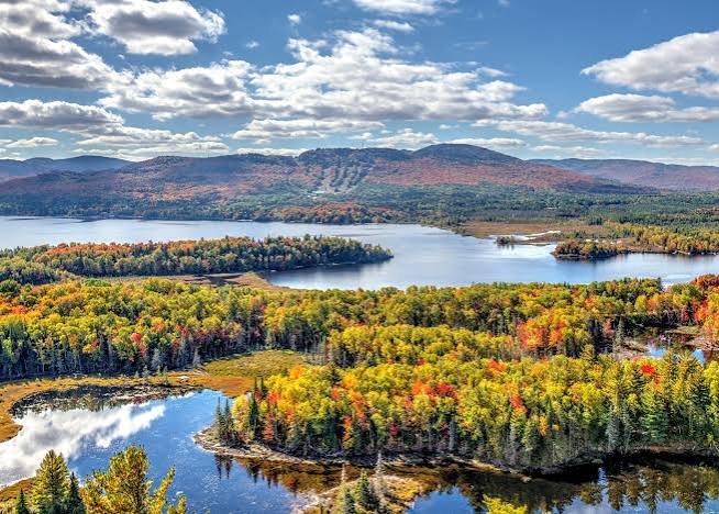
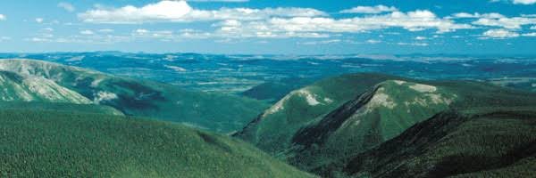
The MRC de Portneuf stretches northwest of Quebec City, where the St. Lawrence River quietly gives way to the first ridges of the Canadian Shield. This territory of contrasts marries the farming lowlands of the St. Lawrence valley to the forests and lakes of the Laurentian plateau.

Crossed by the Portneuf River and the majestic Jacques-Cartier, the region draws outdoor lovers and epicureans alike. You find villages of remarkable heritage character there — Deschambault-Grondines, Cap-Santé, Neuville — where stone houses and old churches stand proudly facing the river.

Portneuf is also a generous pantry: fine cheeses, artisanal charcuterie, microbrewery beers and local products abound. The Route des Saveurs de Portneuf makes the case well. Between grand nature and local treats, this MRC deserves your time, far from the too-well-beaten track.

Practical information

Duration
1 journée
Season
Mai 2026
Getting around
Tesla
Accommodation
N-A

Itinerary

Chargement de la carte…
1
Québec
2
Vallée du Bras du Nord
3
Québec

Portneuf

Saint-Raymond

Vallée du bras du Nord

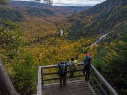
About an hour northwest of Quebec City, in the Portneuf region at Saint-Raymond, lies one of the best-kept natural gems of the Capitale-Nationale: the Vallée Bras-du-Nord. Nestled in a setting of mountains, forests and crystal-clear rivers, this valley is a genuine playground for outdoor lovers and a complete change of scene only a few kilometres from the city. What makes the Vallée Bras-du-Nord unique is its cooperative management model and its immense diversity of activities. This outdoor destination offers 80 kilometres of hiking and snowshoe trails, and 100 kilometres of singletrack mountain bike trails. The park also offers canyoning, via ferrata, fatbiking and ski touring. On the water side, there are 17.5 km of flatwater river descent. In short, whatever the season or your level of adventure, there is always something to discover!

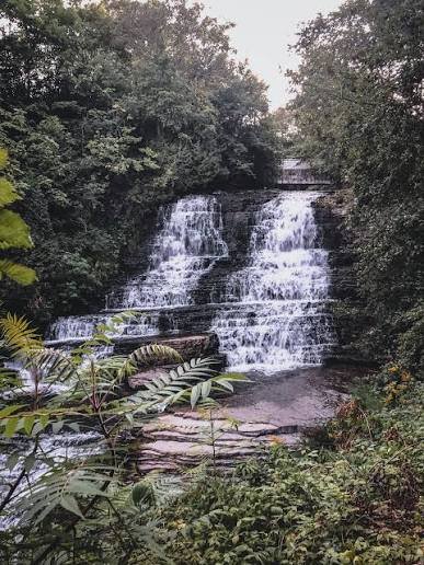
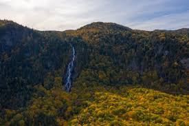
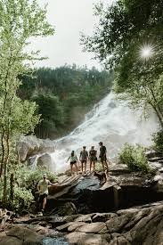
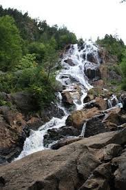
But if there is one must-see in the valley, it is without question the majestic Chute Delaney. The Delaney falls are a remarkable 150-metre cascade located in the Vallée Bras-du-Nord. They stand out for their spectacular natural setting, made up of several small falls spread over the whole height, creating an atmosphere different from that of high-volume falls such as Montmorency. The result? An airy, almost poetic cascading waterfall that seems to slide down the cliff face in an enchanting boreal forest setting. The falls are reached by a thoroughly pleasant trail. By far the valley's classic, this short and very accessible trail follows the river its whole length to end at the Chute Delaney. This force of nature, which never stops astonishing, has often met the wonder-struck gaze of walkers young and old, sometimes on their first hiking outing. The trail starts at the Shannahan welcome centre and follows the river for 4 km, under a mixed forest canopy, to the foot of the majestic falls — a route of about 8 km round trip, accessible to families and to every level. At the start you cross a rather amusing rickety bridge that gives you a touch of vertigo, just enough to add spice to the adventure! Once at the foot of the falls, it feels good to sit on the rocks, take out your lunch and let the rumble of the water lull you. The sight is striking, particularly in spring when the snowmelt multiplies the flow. For the more adventurous, it is even possible to continue climbing up to the Delaney yurt, perched 200 metres up on a cliff.
Highlights

  • •
    Vallée Bras du Nord et ses sentiers
  • •
    Chute Delaney

Photo gallery

Portneuf (spring) 1
Portneuf (spring) 2
Portneuf (spring) 3

Frequently asked questions

Is the Chute Delaney trail difficult?
No, it is the valley's accessible classic. It starts at the Shannahan welcome centre and the trail follows the river for 4 km under a mixed forest canopy, so about 8 km round trip. It suits families and every level, including those on their very first hiking outing.
When are the falls at their most spectacular?
In spring, when the snowmelt multiplies the flow. The Delaney falls are 150 metres high and stand out for their many small cascades spread over the whole height, which creates an airy, almost poetic atmosphere, very different from high-volume falls such as Montmorency.
Is there anything unexpected along the route?
Yes, at the start you cross a rather amusing rickety bridge that gives you a touch of vertigo, just enough to add spice to the adventure. Nothing dangerous, but it does surprise you the first time. Once at the foot of the falls, it feels good to sit on the rocks, take out your lunch and let the rumble of the water lull you.
What activities does the Vallée Bras-du-Nord offer?
Far more than a waterfall. You find 80 km of hiking and snowshoe trails, 100 km of singletrack mountain bike trails, canyoning, via ferrata, fatbiking, ski touring and 17.5 km of flatwater river descent. Whatever the season or the level of adventure, there is plenty to do.
Can you extend the hike beyond the falls?
Yes, for the more adventurous it is possible to keep climbing up to the Delaney yurt, perched 200 metres up on a cliff. It is distinctly more demanding than the basic trail, but the reward matches the effort.
How far is the valley from Quebec City?
About an hour northwest, at Saint-Raymond, in the MRC de Portneuf. That is what makes the place so interesting: a complete change of scene in the mountains and the boreal forest, only a few kilometres from the city. A thoroughly realistic day trip.
What is the valley's cooperative management model?
It is what sets the Vallée Bras-du-Nord organization apart: a cooperative model that brings together landowners, the local community and users rather than a strictly commercial management. The result is a vast, well-maintained territory, open to the public, where the revenue goes back into the community.

Comments

Loading comments…

Around this place

35 m from Quebec City · 233 km from Montreal

See all our places on the map →